


Gard Hérault etap2

taguette
User
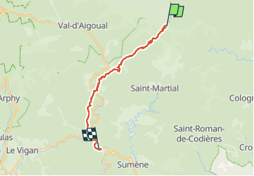

Length
19.2 km

Max alt
919 m

Uphill gradient
531 m
Km-Effort
29 km

Min alt
180 m

Downhill gradient
1266 m
Boucle
No
Creation date :
2024-05-09 06:19:05.334
Updated on :
2024-05-09 14:05:30.469
7h45
Difficulty : Very difficult

FREE GPS app for hiking
 SityTrail
IGN / Geographical institutes
SityTrail Plus
The world is yours!
About
Trail Walking of 19.2 km to be discovered at Occitania, Gard, Les Plantiers. This trail is proposed by taguette.
Positioning
Country:
France
Region :
Occitania
Department/Province :
Gard
Municipality :
Les Plantiers
Location:
Unknown
Start:(Dec)
Start:(UTM)
559806 ; 4880879 (31T) N.
Comments